Cycling Routes in Kyoto
A visual guide from the Kyoto travel guide — see all posters in Visual Guides.
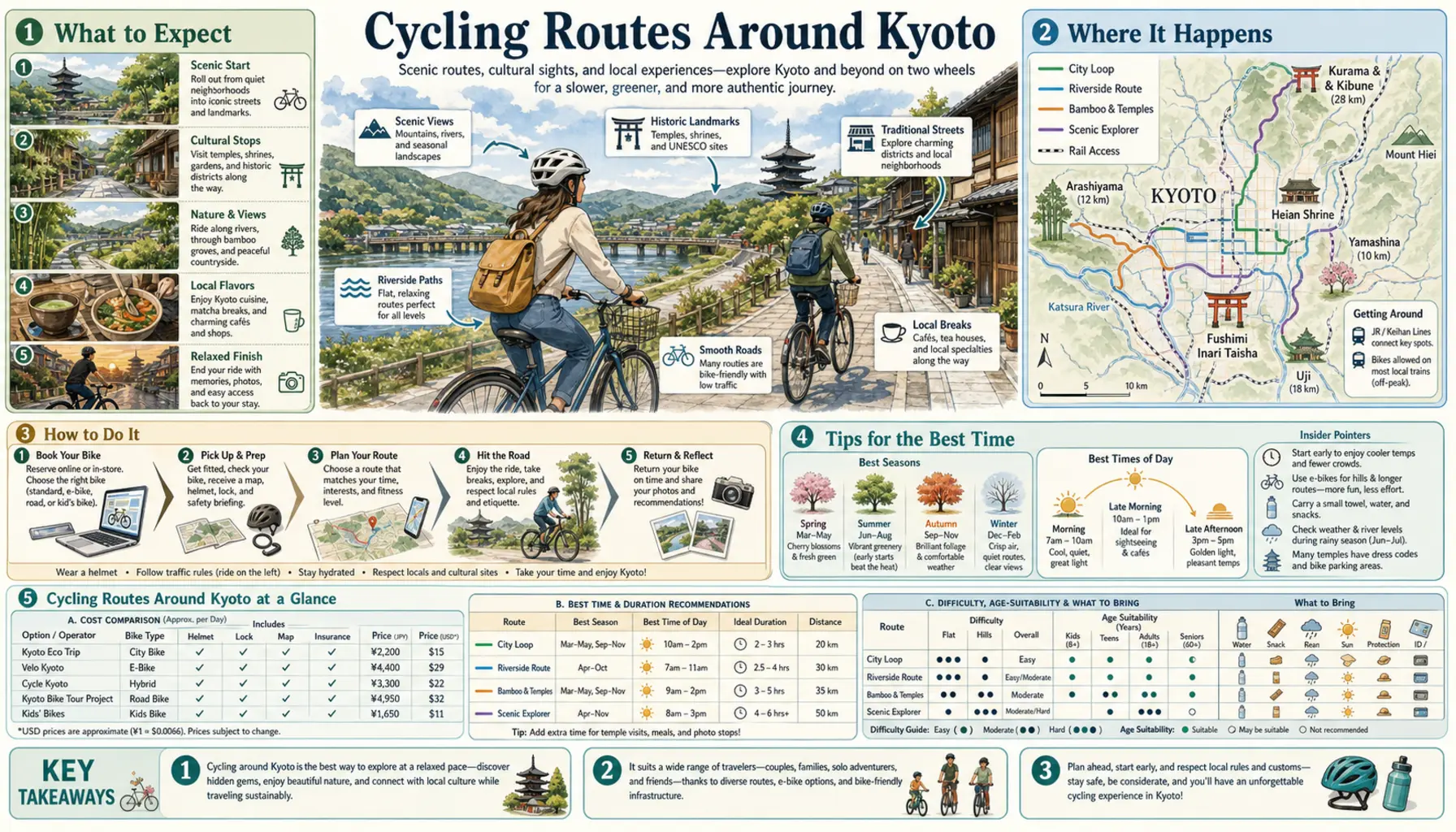
Kyoto was laid out on a grid in 794 and the middle of it is almost perfectly flat, which makes a bicycle the fastest way across town — usually quicker than the bus and far more pleasant. The Kamo River is the spine: an unbroken riverside path with no traffic lights, running roughly ten kilometres from Kamigamo down past the stepping stones at the Demachiyanagi delta to Shichijo and beyond, with herons, joggers and students spaced out along the bank.
The routes
The Kamo path is the default, and the Takano branch at the delta adds a quieter northern leg towards Shugakuin. For a proper outing, follow Marutamachi west and pick up the Katsura River towards Arashiyama, around ten kilometres from the centre and forty-five minutes to an hour, finishing at the Togetsukyo bridge. Riding south along the Uji River reaches Uji in about twenty kilometres. The long one is the Yodogawa cycling road, which runs from the three-river confluence at Yawata down into Osaka in roughly forty-five kilometres, almost entirely away from traffic.
Practicalities
Rentals cluster around Kyoto Station, where Kyoto Cycling Tour Project is the long-established operator, and typically cost about a thousand to fifteen hundred yen a day, more for an e-bike, which earns its price if you plan to ride up towards Ohara. Kyoto enforces parking rules seriously and removes bikes left on central pavements, so use the paid underground bike parks around Kawaramachi and Shijo for a small daily fee. Ride on the left, walk the bike through Nishiki and the Arashiyama bamboo path, and fit lights after dark, because police do check.