History Timeline in Kyoto
A visual guide from the Kyoto travel guide — see all posters in Visual Guides.
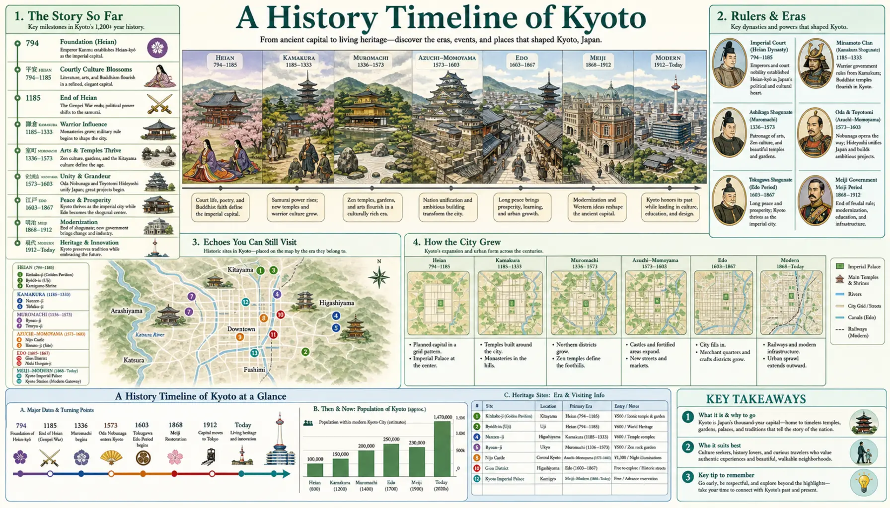
Kyoto's street plan is its oldest surviving object. Laid out in 794 as Heian-kyo on a Chinese grid, it still governs how the city is addressed — north-south, east-west, in numbered avenues — even though almost nothing above ground survives from that century. What follows is a long sequence of burnings and rebuildings: a civil war that flattened the centre in the 1470s, a warlord's reconstruction in the 1590s, the loss of the imperial court in 1868, and the engineering project that put the place back to work afterwards.
The turning points
Emperor Kanmu moved the court here in 794 and it stayed for over a thousand years. The Onin War of 1467 to 1477 destroyed most of the city and set off a century of provincial warfare. Toyotomi Hideyoshi rebuilt in the 1590s, ringing Kyoto with the Odoi earthwork whose fragments still show near Kitano. The Meiji Restoration of 1868 took the emperor to Tokyo and cost Kyoto a large share of its population. The Lake Biwa Canal, finished in 1890, brought water, freight and Japan's first commercial hydroelectric power, and the trams followed in 1895.
Where to see it
Nijo Castle's Ninomaru Palace, with its squeaking corridor floors and painted screens, is the clearest surviving statement of Tokugawa authority in the city. The Museum of Kyoto at Sanjo-Takakura runs the whole chronology and occupies a preserved Meiji brick bank. The Lake Biwa Canal Museum at Keage, usually free to enter, explains the incline and power station just outside its windows. The Kyoto Railway Museum covers the industrial century, and the Hamaguri Gate in Kyoto Gyoen still carries marks from the palace fighting of 1864.