Riverside District in Kyoto
A visual guide from the Kyoto travel guide — see all posters in Visual Guides.
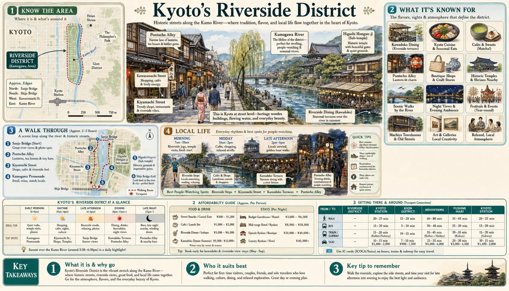
From May to September, restaurants along the west bank of the Kamo between Nijo and Gojo build kawayuka — wooden platforms on stilts extending out over the shallows, lit with paper lanterns, where dinner is eaten in the evening breeze while the river runs a metre below. It is the clearest expression of how Kyoto uses its river: not as a barrier but as the city's main outdoor room. The banks are grassed and public the whole way through the centre, and walking them is the best free thing here.
The stretch between Sanjo and Shijo
This is the busiest few hundred metres in the city. On the east bank, couples sit spaced out along the wall at almost regulation intervals — a genuine habit the city jokes about. On the west, Pontocho runs parallel: a lane barely two metres wide, lantern-lit, lined with restaurants whose back terraces are the yuka platforms. One block further west, Kiyamachi-dori follows the Takase canal, a shallow Edo-era shipping channel now flanked by cherry trees and several hundred bars. Keihan's Gion-Shijo and Sanjo stations and the Hankyu Kyoto-kawaramachi terminus all sit within a minute of the water.
Further along the banks
North of Sanjo the river empties out fast. By Marutamachi there are herons on the weirs, and at Demachiyanagi the Kamogawa Delta has the turtle stepping stones and open lawns, with the Eizan line starting from the station behind. The path continues past the Botanical Gardens towards Kamigamo, roughly an hour's ride on a rented bike. Southward the mood turns industrial around Shichijo and Kujo. A separate riverside sits west in Arashiyama, where the Katsura river runs under the Togetsukyo bridge and the Hozu gorge boats arrive through the afternoon.