Getting Around Bangkok: Transport Guide
A visual guide from the Bangkok travel guide — see all posters in Visual Guides.
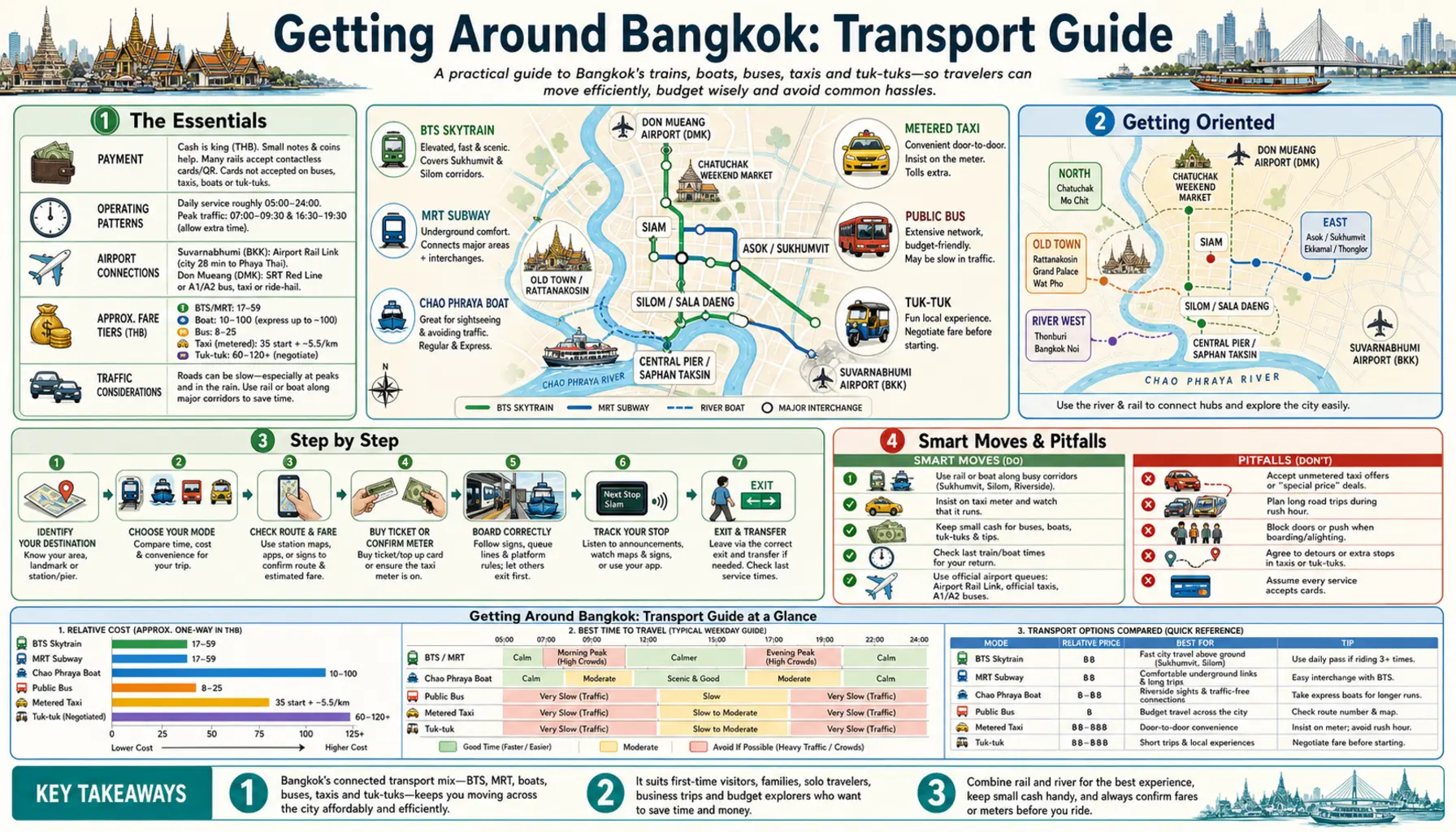
Bangkok's traffic is genuinely as bad as advertised, which is why the city is best read as a rail map with a river running through it. Two Skytrain lines, an expanding metro, two monorails and a commuter line now cover most of what visitors need, and where the rails stop the express boats and canal ferries take over. The working rule is simple: if the trip stays near a line, take the train; if it cuts across the grid, take a boat, or wait out the peak with a coffee.
Rail, boats and canals
The BTS Skytrain runs two lines, Sukhumvit and Silom, crossing at Siam. The MRT Blue Line loops through Chinatown, Silom and Chatuchak; the short Gold Line links BTS Krung Thon Buri to ICONSIAM; the Yellow and Pink monorails reach the outer suburbs. The Airport Rail Link connects Suvarnabhumi with Phaya Thai. On the water, orange-flag Chao Phraya express boats are the cheap workhorse between Sathorn and the old town, and the Saen Saep canal boat cuts from Pratunam towards Rattanakosin faster than any car manages at rush hour.
Taxis, fares and timing
Grab and Bolt price a trip up front and sidestep the refusals that plague street taxis; metered cabs are cheaper still if the driver agrees to run the meter, which is the entire negotiation. Motorbike taxis in orange vests are the fastest way through a jam and comfortably the least safe. Rail fares are modest and distance-based, a Rabbit card covers the BTS, and contactless bank cards now work across much of the network. Avoid road travel roughly seven to nine and four to seven, and add an hour to any plan on a wet evening.