Rivers and Waterways in Bangkok
A visual guide from the Bangkok travel guide — see all posters in Visual Guides.
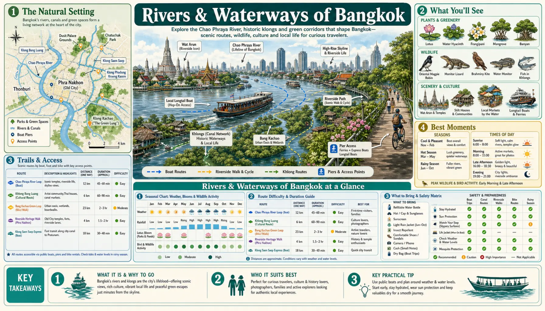
Bangkok was built on water and then paved over most of it. The Chao Phraya still curls through the middle in slow meanders, tidal this far down and busy with rice barges under tow, but the dense canal grid that earned those nineteenth-century Venice comparisons was largely filled in for roads from the 1890s onwards. What survives is worth seeking out: working commuter canals, a car-free island upriver, and a sixteen-square-kilometre bend of mangrove and orchard directly opposite the port that the city never managed to build on.
The waterways that remain
Khlong Bangkok Noi and Khlong Mon on the Thonburi side keep their stilt houses and back-garden landings, and Khlong Bang Luang has the Baan Silapin artists' house in an old teak compound beside the water. Khlong Saen Saep is the working one, a fast and splashy commuter boat running from Phanfa Lilat near the old city out to Pratunam and Ekkamai. Khlong Phadung Krung Kasem, dug in the 1850s as the third city moat, carries a small boat service, currently free, past Nang Loeng towards Bang Sue. The river itself is crossed by the cable-stayed Rama VIII bridge, floodlit and photogenic after dark.
Bang Krachao and Ko Kret
Bang Krachao, the so-called green lung, sits in a tight river bend opposite Klong Toey and is reached by a two-minute longtail crossing to Bang Nam Phueng pier. Inside are narrow elevated concrete cycle lanes threading mangrove and coconut palm, the Sri Nakhon Khuean Khan park, and a weekend floating market at Bang Nam Phueng; bicycles are hired at the pier for very little. Ko Kret, an island created by a canal shortcut in 1722 upstream near Nonthaburi, has no cars, a Mon pottery tradition and a circuit walkable in about two hours. Both are busiest on Sundays.